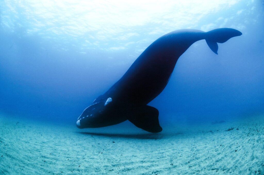
A groundbreaking method is set to enhance the accuracy of right whale distribution models, offering new hope for the conservation of these endangered marine giants. Researchers announced this innovative approach in a recent study highlighted on EurekAlert!, revealing how improved data integration and modeling techniques can provide more precise insights into the habitats and movements of right whales. This advancement promises to bolster efforts to protect the species from emerging threats such as ship strikes and fishing gear entanglements.
Advancements in Modeling Techniques Enhance Accuracy of Right Whale Distribution Maps
Researchers have introduced innovative modeling techniques that significantly refine the accuracy of right whale distribution maps, a critical tool for conservation efforts. By integrating high-resolution environmental data with machine learning algorithms, scientists can now predict whale presence with greater precision across vast coastal regions. This breakthrough enables targeted protection measures in key habitats, reducing the risk of ship strikes and entanglement in fishing gear.
Key improvements in the new approach include:
- Enhanced spatial resolution using real-time oceanographic data
- Adaptive models that update predictions based on seasonal whale movements
- Incorporation of acoustic monitoring to verify whale locations remotely
| Model Feature | Previous Accuracy | Current Accuracy | Impact on Conservation |
|---|---|---|---|
| Spatial Resolution | 10 km grids | 2 km grids | Finer habitat targeting |
| Temporal Adaptability | Static seasonal maps | Dynamic weekly updates | Responsive management actions |
| Data Integration | Satellite only | Satellite + Acoustic + Environmental | Improved detection rates |
Integrating Environmental Variables Offers Deeper Understanding of Whale Habitats
Recent advancements in modeling right whale distribution have highlighted the critical role of integrating environmental variables to capture the dynamic nature of their habitats. By combining oceanographic data-such as sea surface temperature, chlorophyll concentration, and salinity-with traditional sighting records, researchers can generate more accurate and nuanced maps of whale presence. This approach enables scientists to identify previously overlooked hotspots and better understand the seasonal and spatial shifts driven by changing environmental conditions.
Key environmental factors incorporated include:
- Temperature gradients influencing prey availability
- Phytoplankton blooms indicating rich feeding grounds
- Water depth and currents affecting migratory paths
| Environmental Variable | Impact on Distribution |
|---|---|
| Sea Surface Temperature | Correlates with whale feeding patterns |
| Chlorophyll Levels | Indicates plankton abundance |
| Salinity | Affects habitat preference |
By integrating these variables into predictive models, the scientific community gains a deeper understanding of habitat suitability and potential risks faced by right whales. This refined insight supports more effective conservation strategies and can guide policymakers in designing marine protected areas that align with the whales’ ecological needs amid a shifting climate landscape.
Experts Recommend Targeted Conservation Strategies Based on Improved Predictive Models
Leading marine biologists emphasize the critical role of refined predictive models in shaping effective conservation measures for right whales. By integrating high-resolution environmental data with advanced machine learning algorithms, these models can now forecast whale distribution with unprecedented accuracy. This approach enables managers to pinpoint essential habitats and anticipate changes driven by climate impacts, shipping traffic, and fishing activities. Targeted interventions such as temporal fishing closures and dynamic shipping lane adjustments become more feasible, reducing human-induced threats while promoting ecosystem resilience.
Experts highlight several benefits emerging from this data-driven strategy:
- Improved spatial precision: identifying critical feeding and breeding grounds.
- Enhanced temporal forecasting: predicting seasonal movement patterns.
- Adaptive management: enabling real-time policy adjustments.
Together, these advancements provide a robust framework for conservation policies that balance ecological needs with human activity. The integration of these models is viewed as a significant step forward in safeguarding the endangered right whale population while minimizing socioeconomic disruptions.
| Strategy | Impact | Implementation Timeframe |
|---|---|---|
| Seasonal Fishing Restrictions | Reduces entanglement risk by 60% | Short-term (6-12 months) |
| Dynamic Shipping Lanes | Decreases ship strikes by 45% | Medium-term (1-2 years) |
| Habitat Monitoring Stations | Improves habitat protection efficacy | Long-term (3+ years) |
Insights and Conclusions
As efforts to protect the endangered North Atlantic right whale intensify, this new approach to modeling their distribution marks a significant step forward. By enhancing the accuracy of habitat predictions, researchers and conservationists can better anticipate whale movements and implement timely measures to reduce human impacts. Continued advancements in this field offer renewed hope for safeguarding one of the ocean’s most vulnerable giants.
