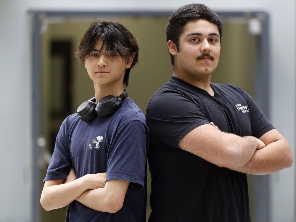
What began as a year-end assignment for a Grade 12 computer science class burgeoned into something much larger.
Published Jun 22, 2024 • Last updated 13 hours ago • 3 minute read
Two Merivale High School students have designed a computer program that uses artificial intelligence to plot the safest travel routes for pedestrians and motorists based on historic accident data in Ottawa.
Rohan Bahl and Matthew Zhou, both 16, spent hundreds of hours building the Traffic Helper app, which began as a year-end assignment for their Grade 12 computer science class and burgeoned into something much larger.
Advertisement 2
This advertisement has not loaded yet, but your article continues below.
THIS CONTENT IS RESERVED FOR SUBSCRIBERS ONLY
Subscribe now to read the latest news in your city and across Canada.
Exclusive articles from Elizabeth Payne, David Pugliese, Andrew Duffy, Bruce Deachman and others. Plus, food reviews and event listings in the weekly newsletter, Ottawa, Out of Office.Unlimited online access to Ottawa Citizen and 15 news sites with one account.Ottawa Citizen ePaper, an electronic replica of the print edition to view on any device, share and comment on.Daily puzzles, including the New York Times Crossword.Support local journalism.
SUBSCRIBE TO UNLOCK MORE ARTICLES
Subscribe now to read the latest news in your city and across Canada.
Exclusive articles from Elizabeth Payne, David Pugliese, Andrew Duffy, Bruce Deachman and others. Plus, food reviews and event listings in the weekly newsletter, Ottawa, Out of Office.Unlimited online access to Ottawa Citizen and 15 news sites with one account.Ottawa Citizen ePaper, an electronic replica of the print edition to view on any device, share and comment on.Daily puzzles, including the New York Times Crossword.Support local journalism.
REGISTER / SIGN IN TO UNLOCK MORE ARTICLES
Create an account or sign in to continue with your reading experience.
Access articles from across Canada with one account.Share your thoughts and join the conversation in the comments.Enjoy additional articles per month.Get email updates from your favourite authors.
Sign In or Create an Account
or
Article content
“We wanted to take it up a notch,” said Bahl, who, along with Zhou, is a Grade 11 student in the international baccalaureate (I.B.) program at Merivale. “There was an absurd amount of time invested in making this.”
Bahl said the idea for the app emerged in the aftermath of a neighbourhood pedestrian accident: A Merivale student was struck by a van and seriously injured in October as he crossed the street at the intersection of Merivale Road and Viewmount Drive.
“We were driven by this passion to not let such things happen again,” Bahl said. “We wanted to create an application so people could route themselves, not just for time and distance, but for safety. It answers the question, ‘How do we take the safest route?’”
Bahl and Zhou, friends since the earliest days of their I.B. program, decided to write a computer program combining open-source data and artificial intelligence to optimize safe travel.
The project began with the design of an algorithm calculating the most efficient route based on time and distance, then the students modified it based on data from Open Ottawa, which offers large datasets listing traffic accidents by location.
Advertisement 3
This advertisement has not loaded yet, but your article continues below.
Article content
The students drew upon OpenAI frameworks and machine-learning models, such as Python TensorFlow and Meta’s PyTorch.
Leaflet, a JavaScript library, provided the open-source map of Ottawa. They also used OSMnx, a Python tool that allowed them to model Ottawa’s street networks, and coding tools such as HMTL, CSS and JavaScript.
Zhou said the most difficult part of the project was ensuring that all of its many pieces worked seamlessly together.
“That took a lot of time because there’s not that that much information out there on Python and JavaScript-linking APIs (application programming interfaces),” Zhou said. “But we eventually figured it out.”
The resulting app, Traffic Helper, allows users to personalize their travel experiences. They can set individual values for safety, time, and distance, which means users can emphasize safety if they so choose.
“There does not exist any other traffic application that optimizes for safety,” Bahl said. “All of the other tools out there — Google and Apple maps — look at what’s the quickest, what is the smallest distance.”
Advertisement 4
This advertisement has not loaded yet, but your article continues below.
Article content
The app, he said, also has potential applications for city planners and can predict the safety and traffic flow implications of adding a traffic light, for instance, to a given intersection.
Available on GitHub, the app is open-source. The students have no plans to commercialize it, but want others to help them build out on it so that people all over the world can use it.
“This app is like a kernel or something. We want other people to join and contribute to this app, to built onto it, so it can be used to benefit more people,” Bahl said.
The app is now limited to Ottawa, but, if more computing power becomes available, it could be expanded to other cities, Bahl said.
Bahl and Zhou, who both plan on careers in computer science or engineering, say they next want to build an online personal assistant tailored to the needs of the elderly and disabled.
Andrew Duffy is a National Newspaper Award-winning reporter and long-form feature writer based in Ottawa. To support his work, including exclusive content for subscribers only, sign up here: ottawacitizen.com/subscribe
Recommended from Editorial
Bankrupt Chelsea Hillier ordered to pay up in Twitter defamation case
One wounded in overnight shooting
Article content
>>> Read full article>>>
Copyright for syndicated content belongs to the linked Source : OttawaCitizen – https://ottawacitizen.com/news/local-news/two-merivale-high-school-students-built-an-ai-powered-app-that-plots-safe-travel-routes
