Home Green Marine Nautical charts of the future will make shipping safer and more sustainable
The Federal Maritime and Hydrographic Agency (BSH), a central maritime authority in Germany, is developing the next generation of electronic nautical charts in an effort to make shipping safer, more efficient and sustainable.

The shipping industry is facing a turnaround — from 2026, nautical charts will not only be fully digitalized but also dynamic.
BSH is developing electronic nautical charts and other nautical products as part of the new EU-funded project Baltic Sea e-Nav together with fourteen other partners from nine countries. The charts are being made on an example of the Baltic Sea.
The hydrographic services standardize and harmonize the data formats and interfaces in digital ship navigation. This is important in order to establish them in international shipping as quickly as possible.
“The Baltic Sea is the perfect testing ground for new applications. If we can do it here, we can do it anywhere,” Dr. Mathias Jonas, International Hydrographic Organization (IHO) Secretary General, said.
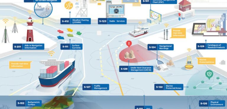
In addition to the electronic nautical chart, various information should be provided depending on the ship and the situation.
“For example, routes and loading can be optimized in real time, safety for people and the environment can be increased, and environmental impacts can be reduced. This paves the way for increasingly automated and autonomous shipping, which is becoming increasingly important,” Helge Heegewaldt, BSH President, emphasized.
Designed for the needs of seafarers
The basis for digital products and services is a new data model from the International Hydrographic Organization (IHO): the S-100 Universal Hydrographic Data Model. The model is necessary in order to produce electronic nautical charts and provide corresponding data products. This includes, for example, information about the seabed, as well as water levels and current conditions on the surface.
The next step is to implement the international standards. This is where the new project, which began in November 2023, comes in. It covers the entire process chain from product development to the distribution of navigation data to end users. In addition to the hydrographic services such as the BSH, research institutes, manufacturers of navigation systems and suppliers of navigation data are also involved.
The aim is to introduce the next generation of electronic nautical charts and other nautical products. The €4.9 million project will provide the basic data for future navigation systems in shipping by autumn 2026. Only with the joint effort it is possible to establish nautical charts of the future, according to BSH.
The digitalization of shipping that can be achieved in this way contributes to the greater safety of people and the environment, new options for routes, and thus more eco-efficient solutions for maritime transport. In addition, e-navigation is fundamental for automated and autonomous shipping.
>>> Read full article>>>
Copyright for syndicated content belongs to the linked Source : OffshoreEnergy – https://www.offshore-energy.biz/nautical-charts-of-the-future-will-make-shipping-safer-and-more-sustainable/